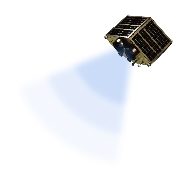
EOS Data Analytics launches 7 optical satellites into a Low Earth Orbit
Get superior insights and make business decisions confidently with EOS SAT - the world's first agri-focused satellite constellation, among companies utilizing remote sensing technologies, uniquely designed to serve agricultural purposes.
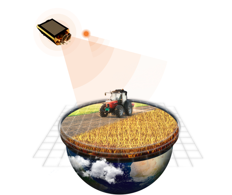
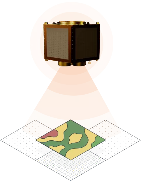
Concept of EOS SAT Constellation
7 satellites in sun-synchronous orbit
Total area covered in 1 day: 10 000 000+ km2
Revisit of global farmlands and forest areas within 5-6 days
1-day revisit of target areas on tasking
Up to 100% coverage of the farmlands and forest areas globally
Full cycle from data acquisition to aсtionable insights delivery in 16-24 hours
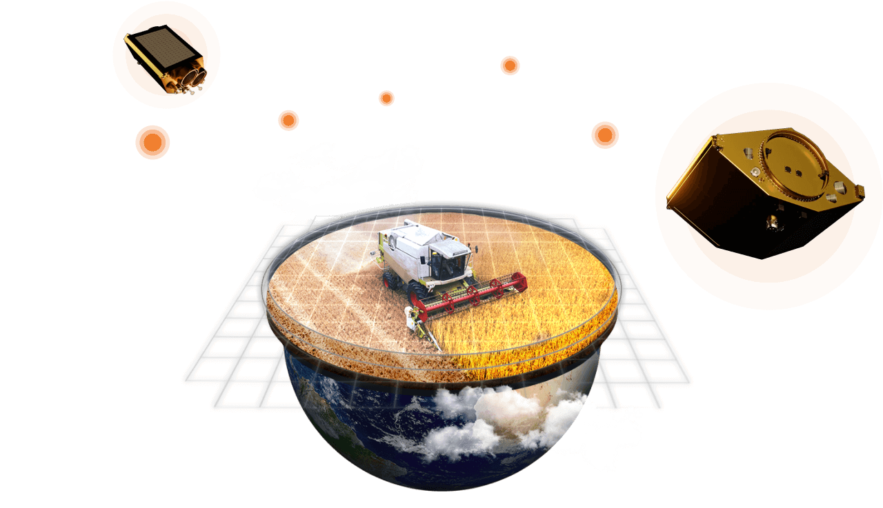

Complete Cycle from Satellite Assembly to Data Processing
Together with the companies which, like EOSDA, are all part of the Noosphere ecosystem, we've established a full-cycle operational process: from manufacturing and maintenance of satellite details to transforming satellite data into actionable products.
Upstream
- Satellite & payload manufacturing
- Satellite launch
- Space engineering and imager products
Satellite's Assembly and Launch
Manufacturing, assembling, and launching EOS SAT. Satellites follow the Earth on a sun-synchronous orbit and collect refracted light through 11 specialized bands
Independent, high-quality data
Manufacturing and integration of EO satellites through tasking or continuous monitoring
Midstream
- Mission control center
- Data acquisition & storage
Receiving and Processing stations
Acquisition of imagery data by 4 ground stations in different parts of the world for the finest output
Downstream
- Data processing
- Data fusion
- Algorithms & Analytics
- Product & services
Quality business insights from our solutions and software
Raw satellite imagery is processed by our proprietary algorithms and transformed into already existing and fully-functional products & services to benefit end-users
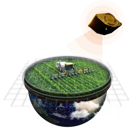
Empowering sustainable practices and precision agriculture worldwide
Thriving while mitigating climate change will require implementing a data-driven approach on every level of the agriculture business. Our mission is to enable each sector of the industry to introduce smart, sustainable agriculture practices that ensure the security of the food supply on Earth. EOS SAT technology allows growers to diminish carbon dioxide emissions and develop sustainable agriculture methods without financial losses.
- Reduce CO2 emissions in agriculture by streamlining operations
- Eliminate pesticide and fertilizer overuse
- Enable food producers to weather climate impact
- Decrease water usage
- Reduce food waste

- Cut back on energy consumption

- Mitigate the upcoming food crisis
Technical Characteristics
| Reference Orbit | SSO |
| Orbit Average Power | 140 W |
| Design Lifetime | 5-7 years |
| Mass | 178 kg |
| Bus Voltage | 24.5 V - 33.6 V |
| Constellation Deployment | 2023 - Coming soon |
| GSD (Ground Sample Distance), Resolution | Panchromatic 1.4 m Multispectral 2.8 m |
| Swath Width | 2 optical payloads with swath width of 44 km for the 500km altitude |
| Spectral Bands | 13 Bands:
|
EOS SAT Constellation Roadmap
-
2021
Test Readiness Review Flight & Operations Readiness Review
-
2023
1st EOS SAT launch
-
Coming soon
Next 6 EOS SAT satellites launch Full Operations Capability
Benefits of using our precision agriculture big data
We combine multiple data points that can be applied in every agriculture business sector
FOOD PRODUCERS
- Streamline operations by leveraging field data
- Achieve precision in field activities
- Get critical information in a timely manner
INPUT SUPPLIERS
- Build strong and transparent relationships with partners
- Monitor the effectiveness of inputs and compare it across seasons
- Follow the latest global input supply market trends
INSURANCE PROVIDERS
- Process claims more easily by having access to hard data
- Assess risks in advance by tracking crop performance
- Manage payout risks smarter by rating fields according to historical data
BANKING AND LOAN INSTITUTIONS
- Allocate investments in a more risk-free way
- Validate loan applications based on the field’s performance history
- Ensure transparency between bank managers and the farmers
AG TECH DEVELOPERS
- Get multiple data points from one source
- Integrate EOSDA Products into your Platform via API access
- Distribute the platform under your own brand with our White Label Solution
GOVERNMENTS
- Monitor large areas at a time
- Make accurate yield projections for entire regions
- Prevent natural calamities
Would you like to invest in the future of agriculture?
Satellite-as-a-Service for agro purposes
Step 1
SATELLITE-AS-A-SERVICE (SaaS)
Vegetation indices, Soil moisture, Growth stages, Weather risks, Data manager, Fertility scripting
Step 2
MODEL-AS-A-SERVICE (MaaS)
Land cover & Land use, Crop classification, Field boundaries detection, Yield prediction, Harvest status monitoring, Cloud mask generation
Step 3
PRODUCT-AS-A-SERVICE (PaaS)
Virtual Farm, Farm Digital Twin Agro-Simulator
A virtual farm is a digital model of your farm's operation in near real time, built on an in-depth data analytics. Here, you can track field activities across all your fields at a time - spot and prevent threats, optimize key resources, perform effectively as a decision-maker