Advanced Soil Moisture Analytics Solution
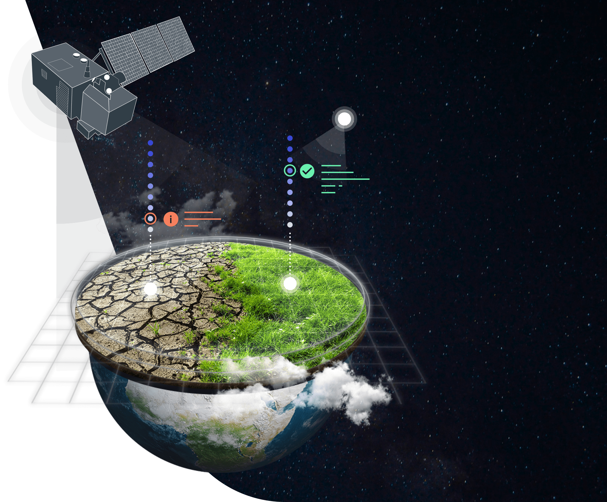
Water gives life to plants and all of us but it can also play a destructive role in crop production. While rainfall can be used as an indirect indicator of water availability for plants, soil moisture is a more critical indicator. Therefore, EOSDA takes the need for precise remote soil moisture content monitoring very seriously.
Our team of dedicated R&D scientists relies on crucial data obtained from several satellites that monitor soil moisture daily all around the globe using microwave radiation. They apply proprietary algorithms to this imagery to develop effective and accurate soil moisture analytics models.
The resulting surface-level and root-level soil moisture maps can be used for daily monitoring, accurate yield estimations, and for studying important climate trends.
Solution's Capabilities
EOSDA team has worked hard to provide you with crucial data on soil moisture:
- Soil moisture at a surface level (0-7cm)
- Soil moisture at root zone (up to 70 cm deep)
- 250m resolution for large-scale data analysis
- Historical data since 2002 and daily updates
- Not affected by clouds or vegetation
- 2-3 day / daily revisit globally (depending on the satellite)
- Available within six hours of satellite overpass
Remote Soil Moisture Monitoring Applications
- Combining soil moisture maps with other types of data allows decision-makers in agriculture and natural resources to improve crop planting strategies, yield forecasting, weather forecasts, drought & flood monitoring, and more.
- A soil moisture map is crucial in identifying the areas unsuitable for planting crops due to excessively dry, wet, and/or frozen soil, among other factors. This data not only helps to improve sowing strategies but also to increase the accuracy of field-level statistics.
- Since irrigation plays an essential role in raising abundant and healthy crop yields, soil moisture maps are of critical importance. Precision irrigation can help reduce the energy and water costs, as well as prevent crop stress.
- Soil moisture analytics using remote sensing has uses a sustainable edge as well. Long-term soil-moisture datasets can be used in modeling future climate change patterns based on which mitigation strategies can be formulated.
- Historical soil moisture maps for every season since 2002 at the fingertips of insurance companies can help them carry out a more comprehensive assessment of drought and waterlogging risks on a regional scale, thus making better-informed insurance pay-out decisions.
How Can Remote Soil Moisture Monitoring Help Your Business
- Based on the soil moisture archive dating back to 2002, you can determine which type of crop better suits the local conditions: the more moisture-resistant crops or those more sensitive to high levels of moisture.
- Thanks to remote precision soil moisture monitoring, you can more easily decide on the proper preparation of the soil for sowing and germination techniques for growing healthier crops.
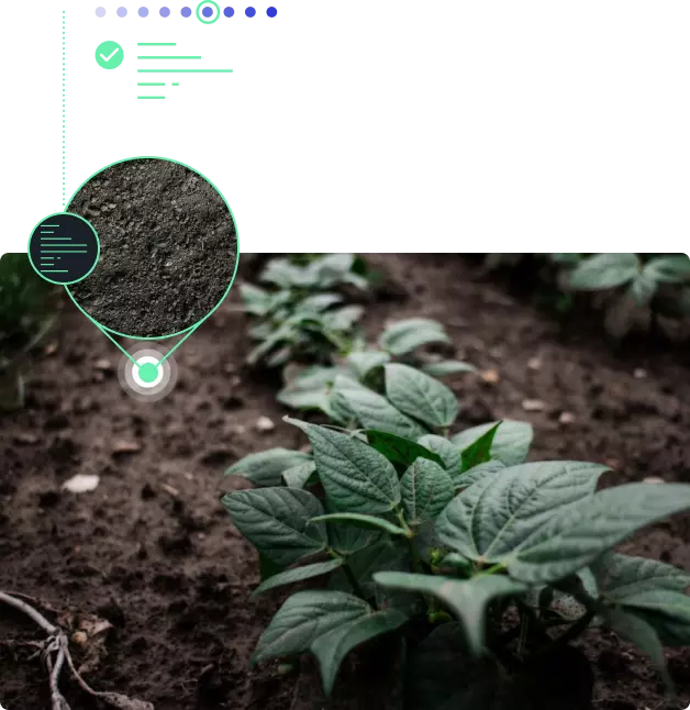
- By remotely measuring the soil moisture content at the root level, you get a more comprehensive picture of the crop state all throughout the season and can adjust your field activities accordingly.
- The in-depth soil moisture analytics provides you with a much better understanding of the amount of water to be used in and the frequency of the irrigation activities throughout the season.
Tech Expertise
We analyze the radar satellite imagery to provide you with ready soil moisture maps.
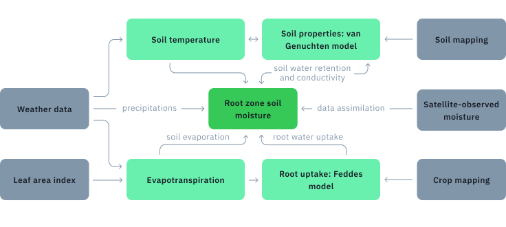
EOSDA's R&D Team has developed a comprehensive and innovative satellite-based soil moisture analytics model that includes but is not limited to:
- Coupled moisture and heat transfer equations
- Nonlinear coefficient dependencies
- Root water uptake model
- Potential evapotranspiration model
- Crop leaf area index growth model
The soil moisture data report in GeoTIFF format will be updated every 1-2 days.

Proved In The Field
Task: Data Validation Using 250 Ground Stations All Across The U.S.
The accuracy of EOSDA soil moisture maps has been validated by comparing data on soil moisture with rainfall (precipitation) data retrieved from over 250 ground weather stations in multiple locations across the United States. Both data trends demonstrate a significant match proving the accuracy of our solution.
- R_pearson = 95.5953
- R_spearman = 84.9421
- rmsd = 0.03
- N = 119
- nrmsd = 0.0976
- ubrmsd = 0.0286
- bias = 0.0088
- Station data
- SM from AMSR
SM value
Date
- 0.0
- 0.1
- 0.2
- 0.3
- 0.4
- 0.5
- 0.6

- 2018-01
- 2018-03
- 2018-05
- 2018-07
- 2018-09
- 2018-11
- 2019-01
Mapping Out The Moisture Content Of Soil For The International Insurance Company In Lithuania In 2021.
EOSDA collaborated with an international insurance company to carry out a soil moisture mapping project in Lithuania. Based on the obtained historical data since 2002, we successfully detected the drought trend for the whole country. This trend was represented as a specially developed index that would allow the company to give out insurance payments based on objectively verifiable soil moisture maps.
The SMI (Soil Moisture Index) was suggested by the EOSDA team.
Its main advantages for the insurance company are:
- reinsurance of risks on an international level
- independent source of information to validate the insured event
- elimination of administrative expenses for the insurer and the insured alike
- transparency and standardization of the contract structure
- universally applicable and simple to use

Soil moisture AMSR2
-
Radiative transfer model
-

Brightness temperature
-

Land surface temperature
-

Clay content
-

Sand content
-
Soil content
-


Why EOSDA Solutions
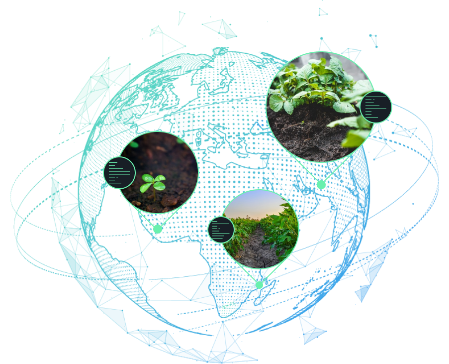
EOSDA's own R&D team has 3 years of experience in developing and implementing the remote soil moisture monitoring solution. Customers in 7 countries have already benefited from this technology.
Our remote soil moisture monitoring solution is scalable and relies on a completely automated data acquisition process.
We are ready to provide technical assistance with data analysis to help you get the most useful insights from the solution.