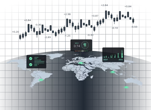
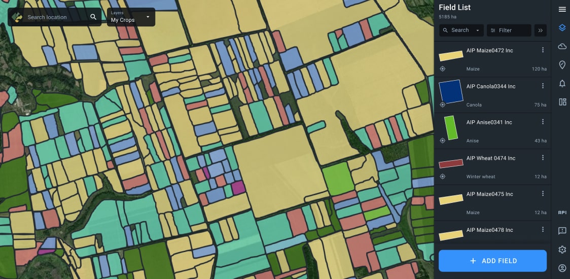
Agricultural Financing: Space And Data Driven
We’re living in tumultuous times of climate change and political uncertainty often having a negative impact on agriculture. Providing farm credit loans and insurance to farmers without a clear data-based picture at hand can, therefore, come at very high risk.
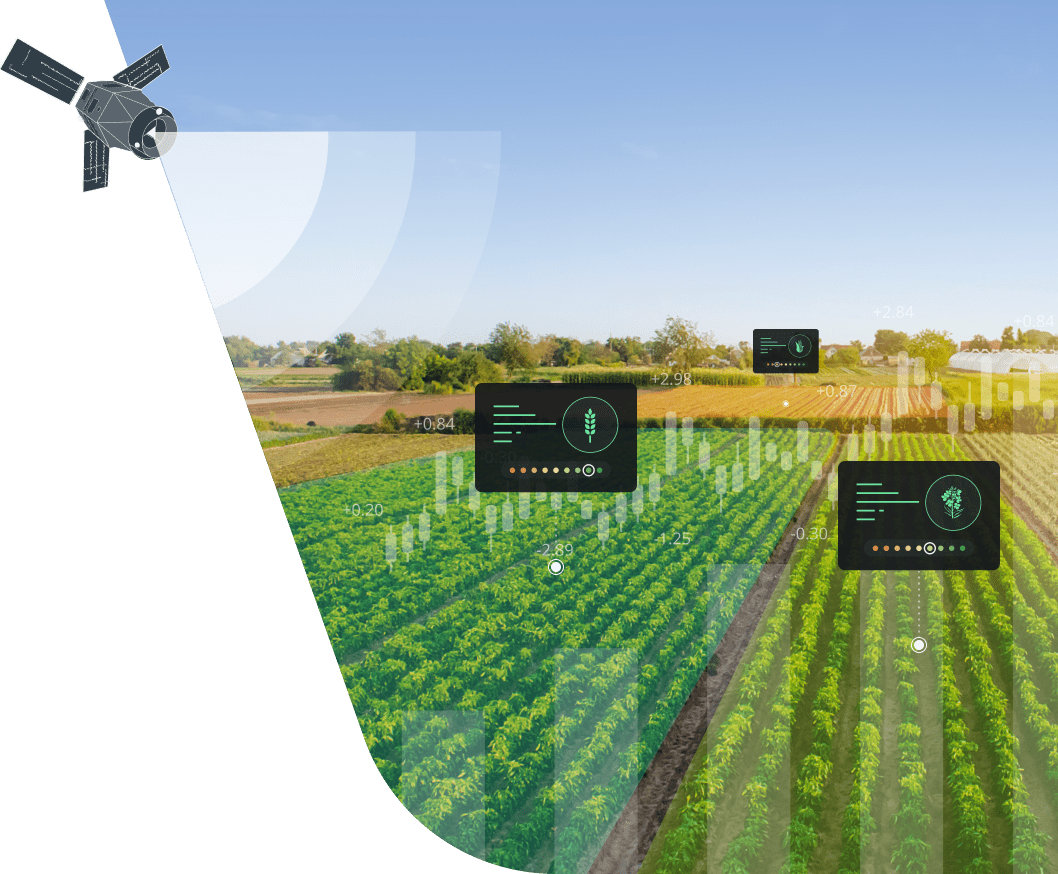
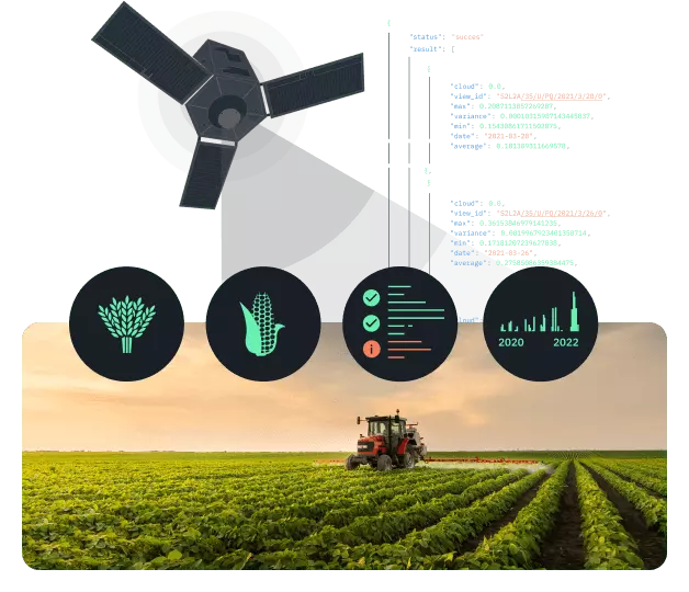
This is why we’ve developed EOSDA Crop Monitoring – a digital platform that leverages satellite imagery and the latest AI technology to assist banks and financial institutions in decision-making. Thanks to historical data and access to various parameters related to crop health in one place, you can remotely assess risks, set threshold yield values, and build trusted relationships with your clients.
What We Offer Banks
Agricultural Lending
- Risk assessment before making a farm loan
Minimize risks related to giving farm loans by accessing crucial field-level data for both current and past seasons, including soil moisture, crop performance, weather parameters, and more. Learn which crop types grew on the field in previous years and how they performed – then decide on your course of action.
- Remote field monitoring on a regular basis
Optimize your farm credit system with remote satellite monitoring of the fields that have been credited. Check if the actually grown crop type matches the one stated in the credit agreement, control the sowing dates, track various field activities, and more.
- Determine the farm loan ROI time frame
Estimate the approximate dates for the returns on investment from a farm loan by staying updated on the progress of harvest in every corner of the credited field thanks to the EOSDA’s AI-powered harvest monitoring solution.
- Build farm credit trust
Introduce complete transparency into your relationship with clients thanks to shared access to the same field-level data on the EOSDA Crop Monitoring platform. Secure your return on investment by providing fact-based farm loans.
- Added value to your services
Increase profit by offering your clients access to our satellite-driven digital platform for farmers – EOSDA Crop Monitoring. Get a competitive edge over other banks and improve customer retention.
Insurance
- Risk assessment before deciding on a specific field being insured
Make decisions on giving out insurance coverage for a specific field based on a single source of historical data, such as temperatures, precipitation, vegetation indices (crop performance), average productivity for a selected period of time, and more.
- Safe agricultural financing thanks to insurance fraud prevention
With access to regularly updated satellite imagery and algorithms capable of determining the actual type of crop growing in the field, you can rest assured that no insurance fraud is taking place. Our technology also accurately determines the area of a field from space, leaving no room for exaggerated claims as to the damaged area.
- Cut expenses on damage assessment
EOSDA’s Crop Monitoring assists scouts in the field by guiding them to the exact geographic location where a problem is detected from satellite imagery. A considerable amount of time can be saved and road expenses cut thanks to our precision approach to damage assessment.
- AI-driven parameters as a basis for giving out insurance
Our precision agriculture platform for monitoring crops is equipped with a set of vegetation indices that can be used as parameters to hinge the insurance on - choose between one or multiple indices at your discretion.
- White-label solution for remotely managing index-based insurance
Spend no money on developing comprehensive software for parametric insurance purposes – EOSDA has already done that for you. Decide on the product’s name, visual aspects (logo, color themes, etc.), functionality, and more. We’ll provide support at every step of the way.
- Mutual trust and respect between you and your clients
The high accuracy of data provided by EOSDA and the shared account feature on our ag precision platform will help you to carry out insurance operations in a transparent way, building trust and long-lasting relationships.
- Make your agri financing services more attractive to the customer
Add value to your services by reselling access to useful features on our online precision farming platform to your clients. With the help of our platform, farmers can remotely and regularly track changes in the state of vegetation, monitor the weather, manage all field activities in one place, apply inputs at a lower cost, and much more.
Key Features For Banks
Digital farm credit management is not a science fiction invention: it's real and it's here. EOSDA Crop Monitoring is a digital platform that specializes in storing and taking advantage of large quantities of important farm and field-level data. Every feature focuses on a specific aspect of managing and monitoring field activities, such as planting, fertilization, field scouting, and more. Banks and financial institutions will be able to use a lot of this data as objective parameters for insurance purposes and for carrying out more risk-free decision-making on giving out farm loans.
Historical Data
EOS Data Analytics offers an impressive arsenal of historical data, including:
- Satellite imagery dating back to 1982 from 9 different sources (Landsat-4 to Landsat-9 plus Sentinel-1 & 2);
- Soil moisture statistics;
- Crop rotation data since 2017;
- Minimum and maximum temperatures at each field over a period of time.
- Data on accumulated temperatures and precipitation since 2008 (for some fields since 1979).
All this data will allow you to perfect your risk assessment strategy in agriculture lending.
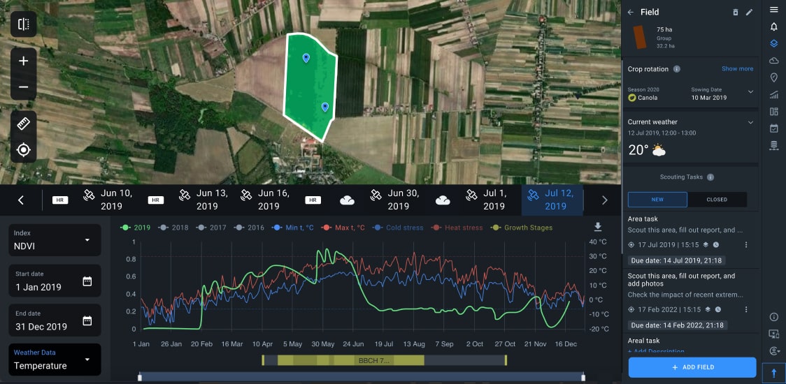
Vegetation Indices
On EOSDA Crop Monitoring, you'll find a whole set of vegetation indices which are excellent credit assessment parameters. A vegetation index is a ratio of several different spectral bands represented as a value measuring some aspect of vegetation or other features in a satellite image. The already built-in indices allow you to monitor crops at different growth stages. On request, we can also add indices specifically tailored to your needs.
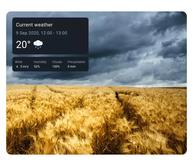
Weather Analytics
Stay updated on daily and hourly changes in weather parameters occurring at the fields of interest. Weather impacts crop performance, which, in turn, is directly related to farm loan risks. This is why we offer current weather monitoring by hour (24/7) with parameters like wind speed and air humidity, a 14-day forecast to optimize planning, and data on accumulated temperatures and precipitation for the last 5 seasons – all in one place.
Split View
With this feature, you can compare the state of vegetation on a field before and after an insurance event. You can switch between different vegetation indices for a more comprehensive analysis. For instance, you can compare NDVI with MSAVI during the early growth stages, to get a more accurate value. The same field can be compared for different dates or two fields for the same date.
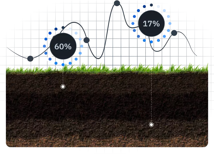
Soil Moisture Analytics
Soil moisture is an important crop health indicator that can be used in parametric insurance. Historical soil moisture data also provides a reasonable basis for giving out farm loans. EOSDA offers access to data on the water content in the soil at different depths (at surface level and as deep as 70 cm) for every season since 2015. Get data on a regular basis thanks to the 1-2 day revisit.
API Access
We also offer a fast and easy API access to the latest satellite imagery and tons of critical data for parametric insurance and agricultural lending, including:
- latest satellite imagery from 9 different sources;
- 15 vegetation indices;
- 14-day weather forecast;
- 1h and 3h weather monitoring daily;
- historical data since 2015;
- multiple satellite bands;
- accumulated precipitation.
All this data will help you stay ahead of the game in decision-making.
Custom Solutions For Banks
Yield Prediction
- Set the minimum threshold yield to provide indemnity based on the accurate estimates of the average amount of yield harvested from particular fields. You’ll get detailed .PDF or .docx reports with all the stats. Accurately set minimum threshold will also help you lower the risks related to giving farm loans in the future.

Crop Type Classification Maps
- With the maps revealing the types of crops growing in large areas (even on a regional scale), you can more easily target the right customers, thus expanding your business. Accurate crop maps will also help you to detect possible crop insurance fraud. We use satellite images of 10-m resolution and ground data for higher accuracy.

Field Boundaries Detection
- Track insurance events occurrence and field activities within the areas clearly stated in the insurance contract thanks to accurate field delineation on the map. EOSDA uses an innovative edge-detection algorithm to precisely detect field borders within an area of almost any size.

Harvest Dynamics Monitoring
- Ensure compliance with regulations by monitoring the actual progress of harvesting in the fields of interest. Thanks to data on the number of harvested fields, their total hectarage, and more, you can secure your investments in the agriculture sector.

Advanced Soil Moisture Mapping
- Apart from indices, we offer another critical objective parameter to pivot the insurance contract on – remote detection and measurement of water content in the soil. Moisture is measured as deep as 70 cm below the ground, while the 1-2 day satellite revisit ensures a constant stream of data.

Success Stories
EOSDA Solution For A Bank In Poland (2019)
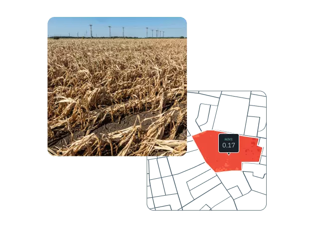
One of thy key issues for the bank when it comes to making farm loans is accurate measurement of field size. Oftentimes, real measurements performed by the insurance agents do not match the ones stated by the clients.
EOSDA's field boundaries detection algorithm relies on the latest obtained satellite imagery to precisely measure the field's area in hectares or acres, depending on the client's preferences. Users can also manually delineate a field on the map on the EOSDA Crop Monitoring platform. The bank was able to remotely determine the field's area in 30 seconds using EOSDA's solutions.
Photo below shows a plot with winter wheat insured by the bank
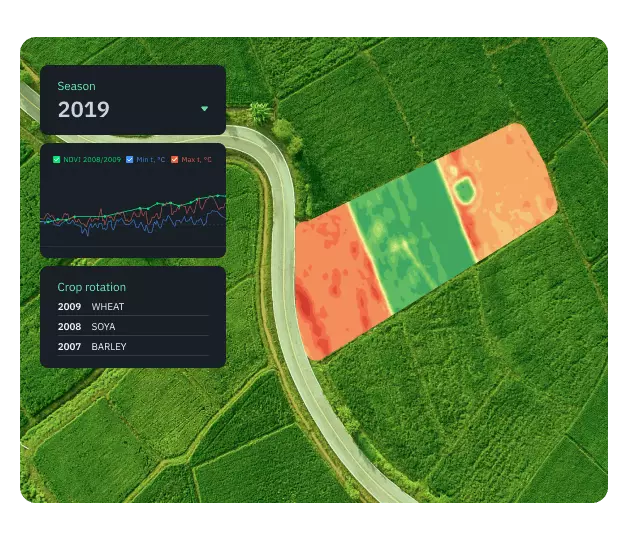
Another challenge to overcome was the assessment of soil conditions and crop health. Some problem areas can remain unnoticed, especially in large land plots, which is a serious detriment to risk evaluation accuracy.
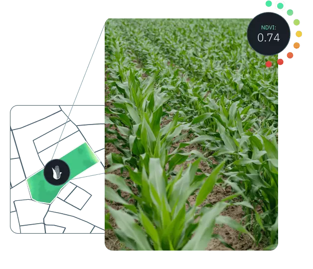
Preliminary field assessment was simplified thanks to the analysis of multi-spectral satellite imagery using the NDVI index. Data on crop rotation for several past seasons was also very helpful as it allows the insurer to make relatively accurate yield predictions and evaluate the damage to the crops with more precision. This eliminated the need of scouting the entire field for problems with crops. Additionally, the platform has a special feature that simplifies the planning and managing of scout tasks using geolocation and online reports.
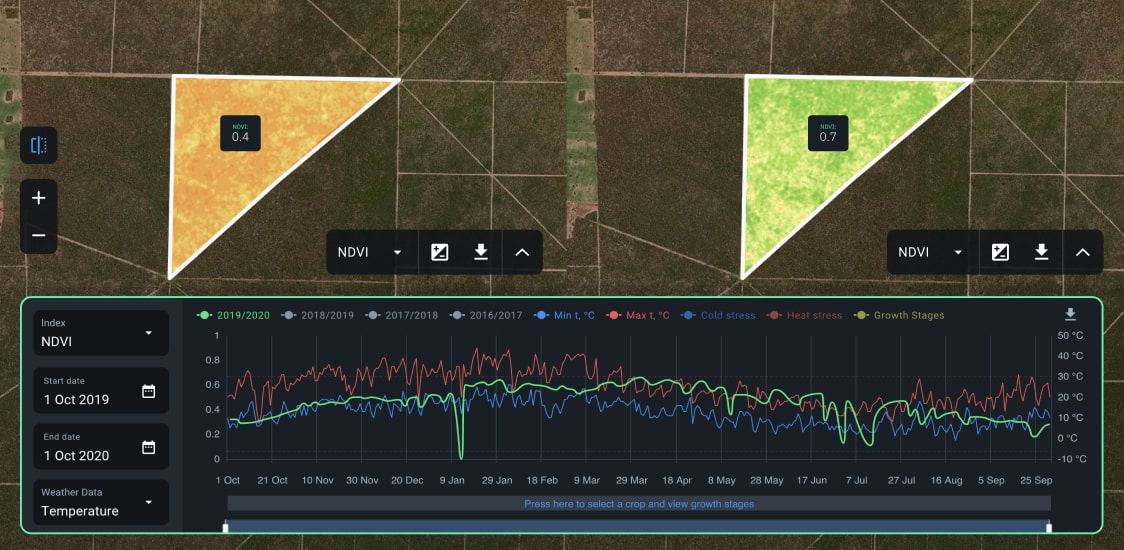
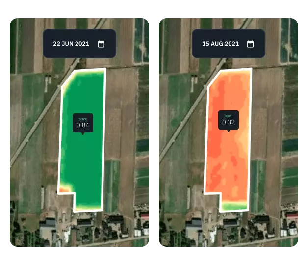
Photo below shows a plot that was denied insurance by the Bank based on the NDVI values for the crops
With EOSDA Crop Monitoring, the bank was able to cut costs on field analytics, estimate the yield and assess damage more accurately and in a much shorter time. In some instances, the bank was even able to make field insurance decisions based solely on satellite data.
Remote Sensing to Improve Farm Credit System
Lack of financial and historical data as a hurdle to farm credit risk assessment by a bank in Argentina.
EOSDA provided data on crop performance and other crucial field-level parameters retrieved from satellite imagery and other sources. The bank got crop classification maps, soil moisture statistics, historical crop rotation data, historical weather, and more, and based on all this data was able to decide on loan payouts. The client found the EOSDA Crop Monitoring's Split view feature of utmost value.
Split view for a plot in Argentina (2020)