Satellite Monitoring Solutions for Agricultural Cooperatives
The world is changing at an alarming rate, and relying on traditional methods of agriculture, such as guesswork, conventional weather forecasts, and cumbersome records, is becoming a risky business. EOS Data Analytics, a leader in satellite-based EOSDA Crop Monitoring solutions, offers farming cooperatives a new, efficient way of managing food production.
With our digital precision ag platform - EOSDA Crop Monitoring - that relies on satellite imagery and constant streams of data collected from multiple sources, farming cooperatives can really thrive. We believe in the power of knowledge to make the world a better place.
Agricultural Solutions for Farming Cooperatives
Lack of analytical data to make informed decisions or provide recommendations for cooperative members
- Data on the current state of crops according to the vegetation indices
- Historical data on the field’s productivity
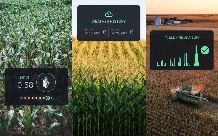
- Accumulated daily temperatures and precipitation for five years
- Hyperlocal 14-day weather forecast
- Scouting feature to speed up field check-ups
- Leaderboard of fields according to crop performance
Expensive agricultural inputs
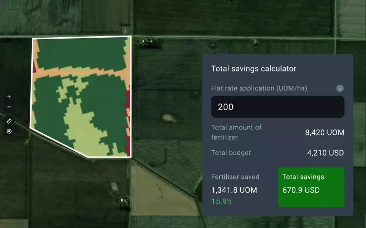
- Productivity maps for precise planting
- Variable rate maps for precise fertilization
- Reliable weather forecast & historical data for timely harvesting
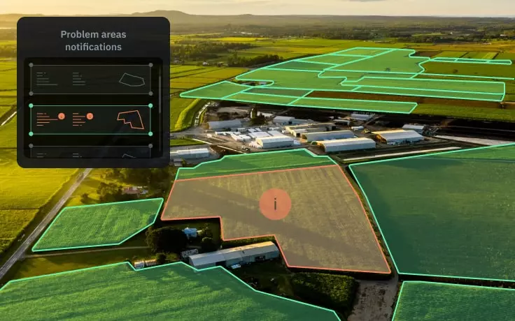
- Sending scouts directly to problem areas
Relying on several different types of software to coordinate efforts
Need to monitor multiple fields scattered over a vast area
Satellite-based Сrop Monitoring Solutions
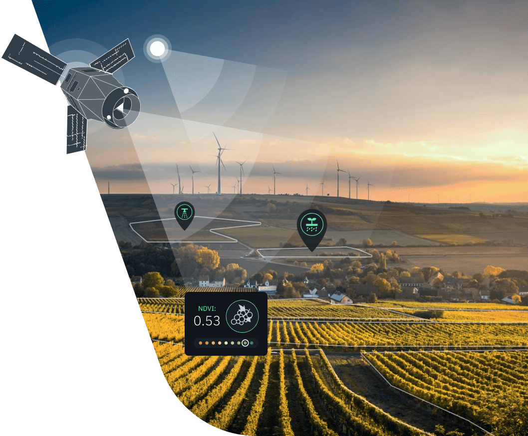
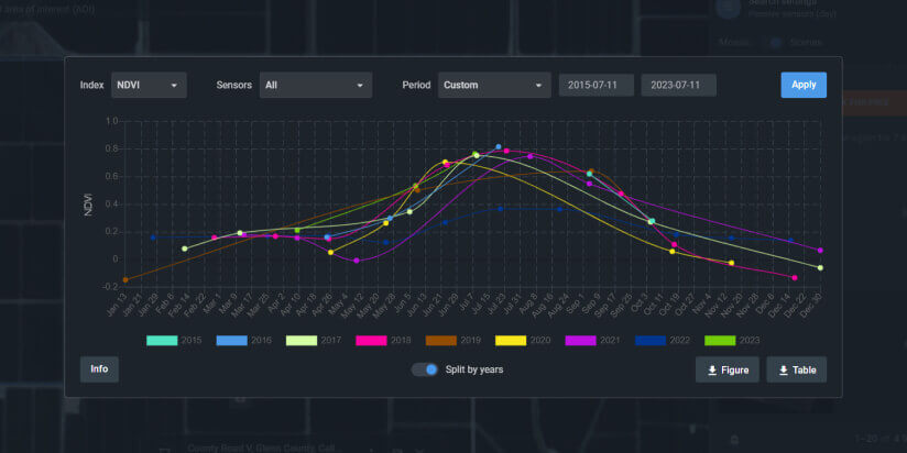
Satellite imagery & vegetation indices
To provide farming cooperatives with data on the current state of crops, we rely on the latest satellite imagery and vegetation indices. Each vegetation index is a mathematical formula specifically derived to enhance particular surface features or parameters - from vegetation density to chlorophyll content.
These simple remote sensing tools can do wonders for agri coops, allowing for tracking changes in the state of crops in multiple fields at once and getting notified about the most critical developments.

Weather analytics
Mitigation of weather risks is one of the priorities when it comes to keeping crops safe and sound. On EOSDA Crop Monitoring, members of farming cooperatives can access daily and accumulated temperatures and precipitation rates at the field’s location available for the past 5 years. You can also enhance field activities planning thanks to a hyperlocal 14-day weather forecast and trace the weather changes during the day hour by hour.

Zoning
Here’s a truly valuable tool for agricultural cooperatives - maps for variable-rate application of seeds and fertilizers. Understand the real needs of your crops in nourishment and which fields need a real boost in productivity. Calculate Vegetation and Productivity maps, download them, and upload into farming equipment terminals to enhance the precision of their performance.

Field leaderboard
With a field leaderboard, members of farming cooperatives can always stay aware of abrupt changes in the state of crops in every field. This feature is especially useful if your fields are scattered across a large area. Get notified about the most alarming and most recent changes in the NDVI value - a crop health indicator.

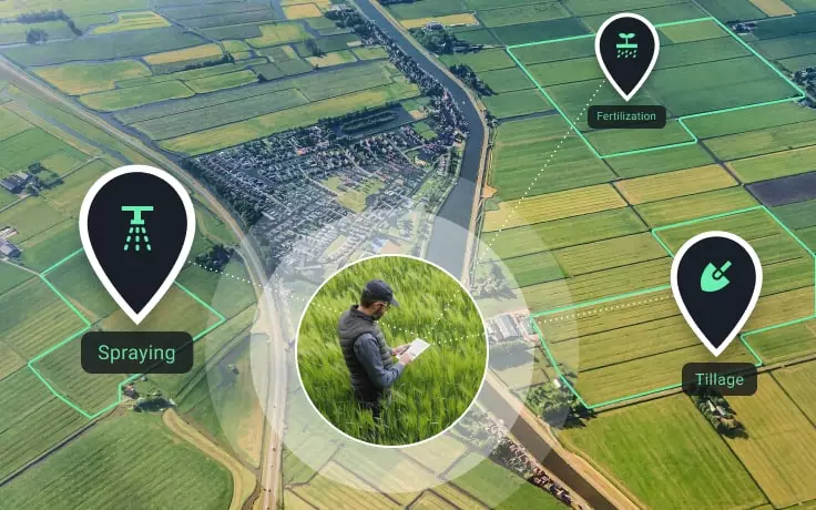
Scouting
One of the top useful agricultural solutions for cooperatives, Scouting is the feature designed to significantly reduce the time and effort necessary for a check-up of a problem area in the field. With the mobile version of EOSDA Crop Monitoring, scouts can find the problem spot using GPS navigation even when they're offline. The app supports the instant report generation option - complete with snapshots and valuable details observed by the scout. As soon as the online report is generated, it can be accessed by everyone who shares the same Team account.

Special Business Solutions on Request


Success Stories
EOSDA Team Successfully Field-Tested SunScan For GoldenEye
EOS Data Analytics scientists acquired and tested the SunScan Canopy Analysis System within the GoldenEye project aimed at advancing sustainable mining practices and environmental care.
Growing Almonds: Conditions For Crop Success
Growing almonds is a complex puzzle where each piece — whether soil preparation, fertilizing, irrigation, or pest management — must fit into place to reveal the picture of a fruitful orchard.
FONCOSPA Uses Remote Sensing In Agricultural Insurance
EOSDA Crop Monitoring provides satellite imagery analytics for FONCOSPA insurance company in Mexico, allowing them to improve accuracy in decision-making.
Satellite Time Series For Discovering Patterns & Trends
A time series of satellite images, much like a well-written biography, tells the story of a particular area on Earth by charting its evolution over time and providing new eye-opening insights.
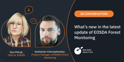
EOSDA Forest Monitoring: An Interview On The Update
In this interview, Vera Petryk, CMO at EOSDA, and Kostiantyn Chernyshevskyi, EOSDA’s Product Manager, reveal the new features and potential of the updated EOSDA Forest Monitoring platform.
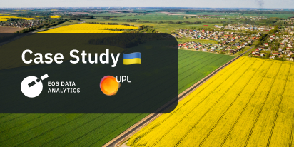
UPL Ukraine Uses SatTech To Remotely Monitor Fields
UPL Ukraine conducts field trials of their input products and remotely assesses the results by using satellite data from EOSDA Crop Monitoring.