Advanced Satellite Solutions For Food Production Companies
Food producers are at the forefront of ensuring food security in the face of climate change, resource depletion, and a spiking population. Lack of timely, reliable data and sky-high fertilization costs take a toll on agribusinesses.
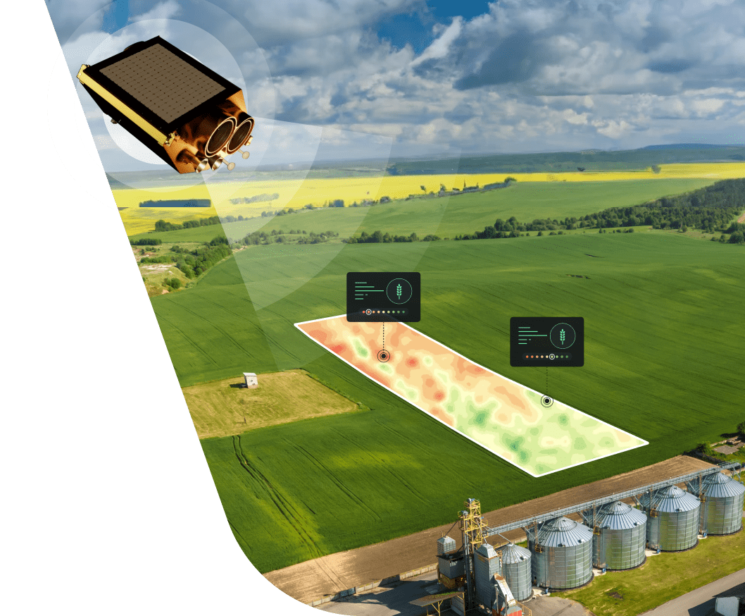
Where traditional farming fails to offer the sought-for solution, satellite technologies come to aid, providing the right information at the right time and supporting decision-making at every step. With EOSDA's satellite-driven precision agriculture solutions, food producers can boost crop production in a sustainable way, hitting that sweet spot where cutting down on inputs drives up their profits.
How food producers benefit from satellites and precision agriculture
Streamlining food production with space data analytics
One of the major obstacles on the way to better food production is the lack of information. EOSDA Crop Monitoring bridges the data gap, offering food producers a wealth of reliable field-level data and actionable insights powered by AI and remote sensing technologies. With a crystal-clear picture of what's going on with the croplands, they can adopt a more cost-effective, risk-averse production strategy and eventually grow more with less.
Biomass Yield Estimation
Available as an add-on, this feature calculates the crop's total biomass and storage organs mass based on weather data, sowing dates, and irrigation type. The underlying model also makes a 2-week prediction to inform a food producer when it's best to harvest.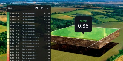
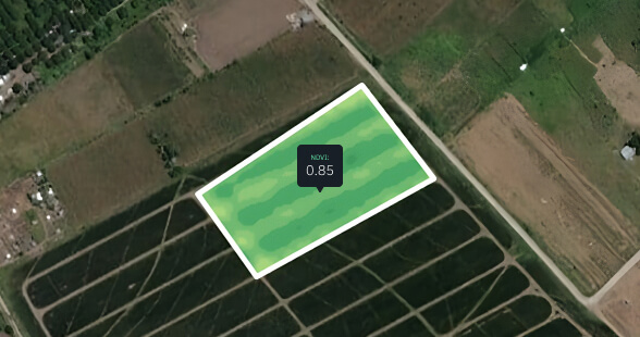
Vegetation Indices
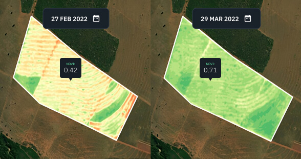
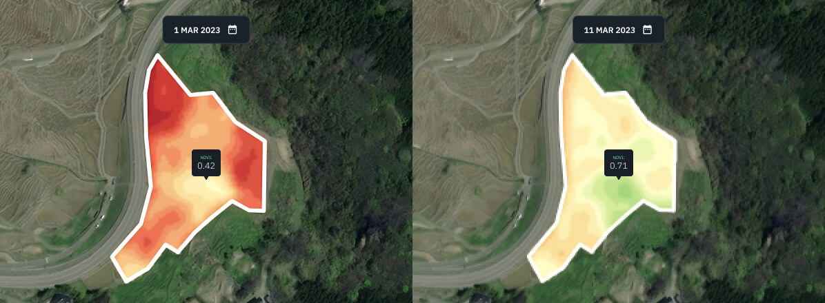
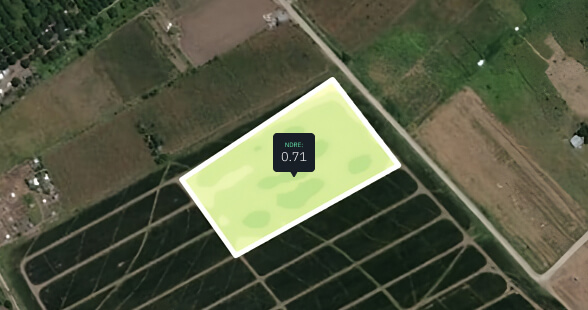
Derived from satellite images, these indices help food producers get an in-depth look into the state of crops. Among almost a dozen of available spectral indices, NDVI (Normalized Difference Vegetation Index) provides the most critical overview of crop health throughout the season by remotely measuring the density of biomass.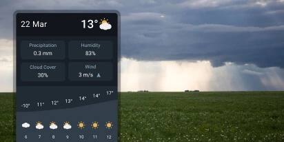
Weather Data
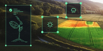
Food security is highly vulnerable to weather impacts. Our platform provides access to reliable 14-day weather forecasting so growers could better manage irrigation, schedule input applications, and take timely actions to protect crops from calamities. Historical weather data is key to making accurate weather forecasts throughout the season.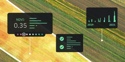
Field Productivity
Productivity can vary within a small field, not to mention large croplands. Knowing the yield history of the field and evaluating its current soil fertility and cropping ability are prerequisites for accurate crop yield prediction.
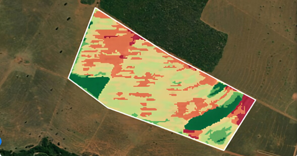
Zoning
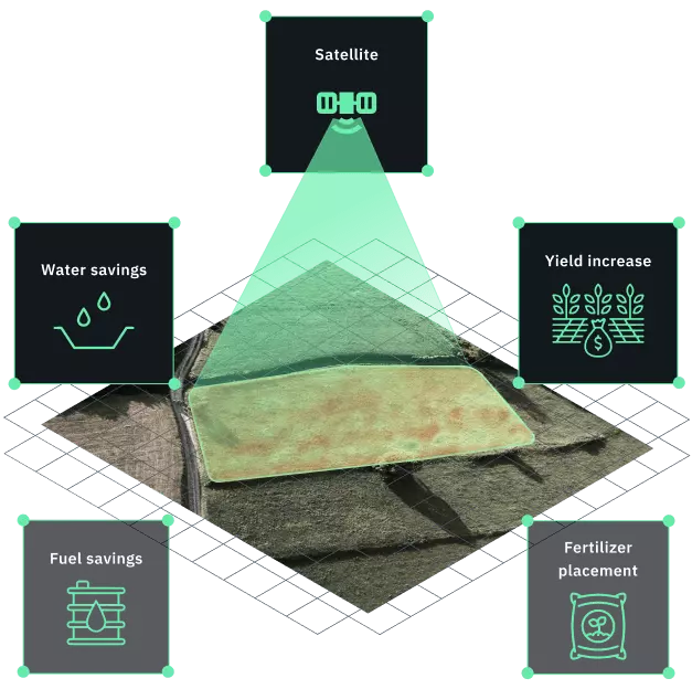
Applying an equal amount of inputs over the entire plot is not always effective since most fields have variations in topography and crop performance. EOSDA Crop Monitoring enables sustainable food production through remote sensing thanks to its handy toolset for variable rate application (VRA). Vegetation and productivity maps assist food producers in applying the right amount of fertilizers and seeds in each zone based on crop performance, which can minimize input waste and translate into massive cost savings.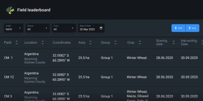
Field Leaderboard
A convenient dashboard providing a quick overview of all the user's fields. It highlights the plots with the biggest drops in NDVI values to help you prioritize field management tasks, focusing on the most urgent issues first.
Team Management
This feature offers shared access to field data and analytics to multiple users within a single account. It simplifies cooperation with partners and ensures better control of employees' performance.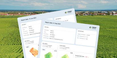
Weekly Reports
Stay updated on the most critical changes in your fields with customizable weekly reports. Owners of multiple geographically dispersed fields can benefit from this satellite-based monitoring feature the most, enhancing overall food production.Individual Solutions For Your Unique Needs
Custom yield prediction
EOSDA has developed a scalable crop yield prediction model, combining remote sensing data and machine learning to improve food crop production. Our custom solution serves as a decision support system for food producers when it comes to planting seeds, detecting low-yielding areas, and managing storage and transportation.
By fusing two yield forecasting models — biophysical and statistical — our data scientists and engineers have achieved maximum accuracy and efficiency of predictions. Thanks to this hybrid approach, we can pursue more complex projects.
- Depending on the quality of statistical data, the accuracy of our crop yield estimates can reach up to 85-95%.
- Predictions can be made up to 3 months before the current season harvesting.
- Over 100 crop types
- Project turnaround: ~14 days

Tailor-Made Solutions For Your Needs
Looking for a service that's not on the list? Our dedicated R'n'D team has a proven track record of designing custom solutions that combine best practices with the unique requirements of clients. We're here to create a project tailored to your problem and help your food production business reap the benefits of satellite image analytics.
- Remote Harvest Dynamics Monitoring
- Crop Type Classification
- Field Boundaries Detection
- Advanced Soil Moisture Analytics

White Label
Scale up your business and drive the implementation of precision agriculture with the White Label offering by EOSDA, which allows reselling our innovative satellite monitoring solution under your own brand. We can swiftly customize the software based on your requests so you could start making extra profit at zero development cost.
What we provide:
- a ready-made solution
- full expert and technical support
- admin panel for easier client management
- flexible customization
- transfer to your own domain, etc.

Satellite API
Our API makes agri-data and analytics more accessible to food producers that depend on precision ag software. Instead of switching between multiple solutions, you can have all relevant field data in one place to streamline farm operations, enhancing their accuracy and ensuring clear communication between workers, without spending extra time and money on new tool management.
Enjoy fast and easy API access to raw, processed data and remote sensing analysis to tackle any negative impact on food production:
- Satellite imagery
- Weather data
- Data analytics