EOSDA LandViewer: Tackling global changes with satellite data
EOSDA LandViewer is a satellite observation imagery tool that allows for on-the-fly searching, processing and getting valuable insights from satellite data to tackle real business issues
- On-the-fly processing
- Smart analytical tools
- Compatible with GIS tools
Get high-resolution images for analytics
Unique proposition
The USP’s main objective is to deliver the high-detail data in the fastest and safest way possible.
Global coverage
In our catalog you can find satellite imagery ranging from 0.4 meter per pixel for any AOI at a reasonably low cost.
Save time, cut costs
Ordering high-quality images directly from EOSDA LandViewer is a very cost-effective and time-saving offer.
EOSDA LandViewer as a time-saver for satellite imagery search
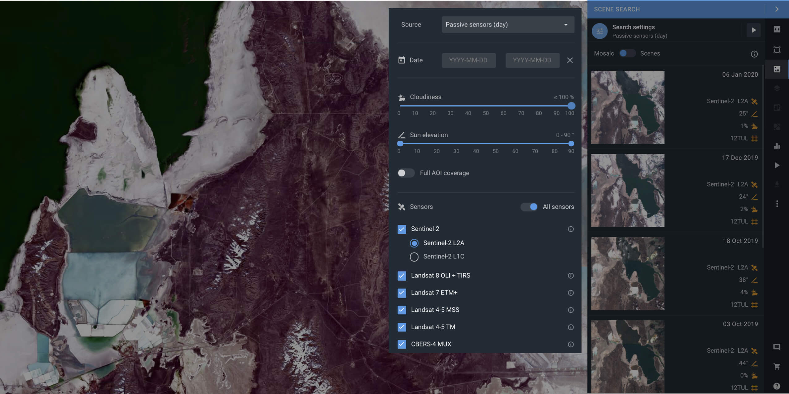
Wasting time on finding the right satellite image of Earth with high resolution? EOSDA LandViewer instantly focuses on specific area(s) of interest to help you find exactly what you are looking for in a short time
Thanks to the on-the-fly spectral index calculations, you can easily download a processed image suitable to your needs, saving time and using less space on your device. Benefit from EOSDA LandViewer’s preview and сonvenient imagery download solutions.
Review them to find the solution for your needs.
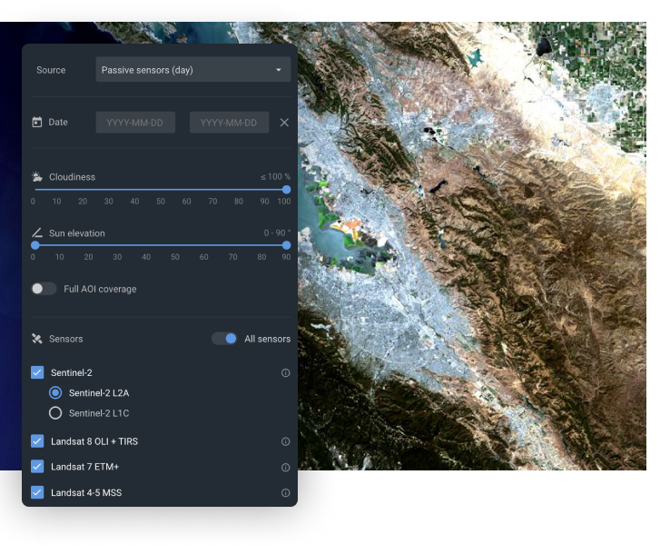
Satellite Imagery
With the help of EOSDA LandViewer, it's now easier than ever to find and download live satellite images you need, browse band combinations, up to date and historical satellite imagery. Pick the sensor that suits your task best.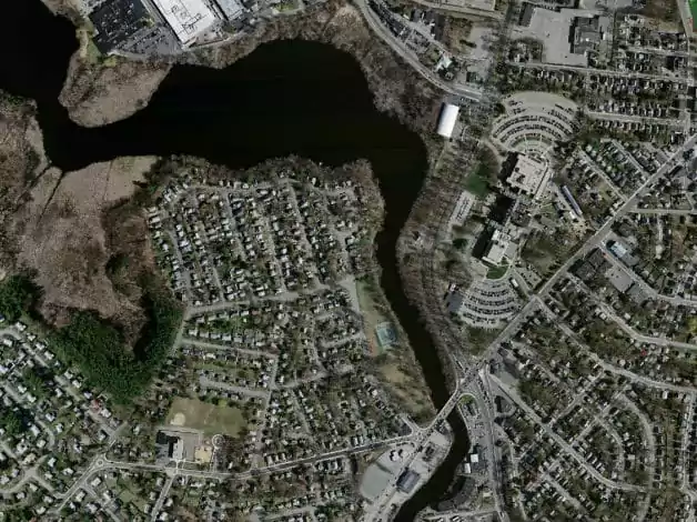
Detailed Analytics
Band combinations empower spatial data imagery analytics. Click here to learn how to correctly apply remote sensing indices to satellite images and interpret them in a proper way.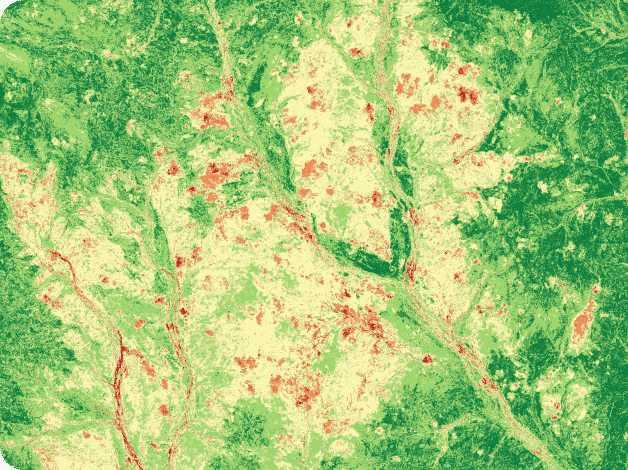
Industries
The most common form of spectral satellite imagery enhancement are indices and band ratios. These are widely used in agriculture, forestry, oil & gas, minerals & mining, as well as many other industries. Learn more with the number of real use cases we have specially selected for you.
High resolution images providers
High-resolution satellite imagery is used in many areas, such as land use change detection, precision farming, mining, construction, defence, among others. The key advantage here is the higher spatial resolution which increases coverage, accuracy and reliability of the data. EOSDA LandViewer goes hand-in-hand with technological innovations, collaborating with the leading satellite imagery providers around the globe. Purchase and resell images with EOSDA LandViewer.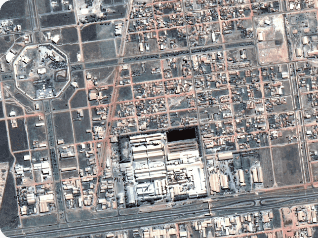
EOSDA LandViewer is a convenient daily satellite images processing tool
Earth view observation via on-the-fly processing, user-friendly interface, and a number of powerful features
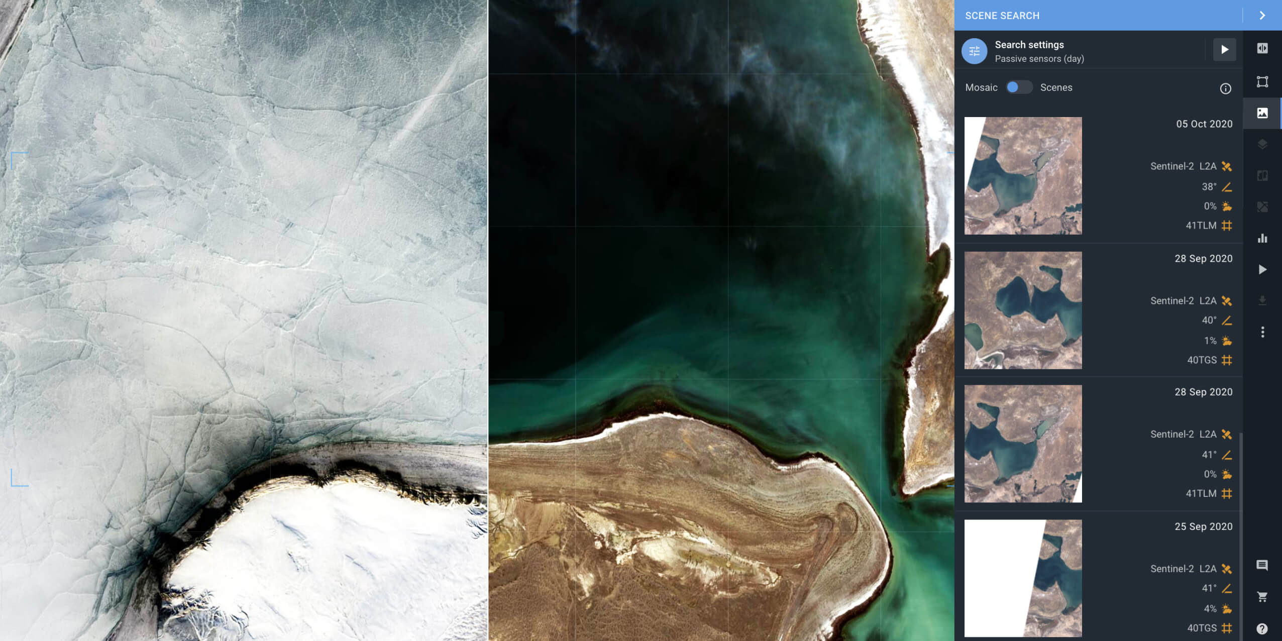
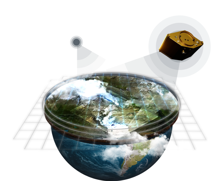
Instant access to petabytes of historical and current satellite images
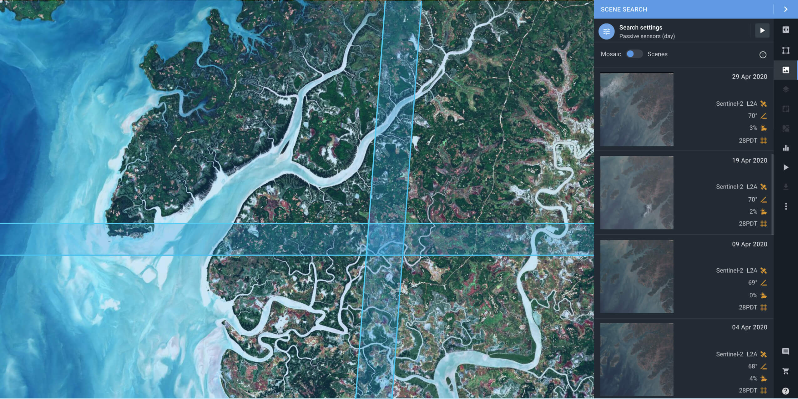
Find satellite images of Earth of any scale in 2 clicks by selecting the area of interest on the map or by entering the location name in the search bar
On-the-fly imagery analytics and download of any image suitable for your own business purposes. Mosaic allows merging multiple scenes into one and performing satellite images mapping of any large area.
EOSDA LandViewer imagery processing technologies
To analyze the data retrieved from satellite imagery of high resolution, we employ a wide array of tools and methods, suitable for most industries
Share your imagery around the globe
We created EOSDA LandViewer as a software which would allow users from different areas of expertise participate in a profitable and mutually beneficial exchange of satellite imagery. Here you can buy and resell images with a level of detail suitable for most industries: agriculture, forestry, mining, fires monitoring, ocean plastic pollution detection, and more.
WMS (Web Maps Service) is a perfect way to integrate EOSDA LandViewer data into a 3rd party tool. You can browse for the most recent satellite images on EOSDA LandViewer and then use popular analytics applications to process them further. Connect the globe visually.